Trat officials work to ease ferry access to Koh Chang amid flash flood disruptions
Trat officials work to ease Koh Chang ferry access after heavy flooding disrupts key roads and bridges on 22 June.
TRAT, Thailand – Local officials in Trat province sprang into action on Sunday morning (22 June) to ensure continued access to ferry piers servicing Koh Chang, after hours of heavy rain triggered flash flooding in key travel corridors.
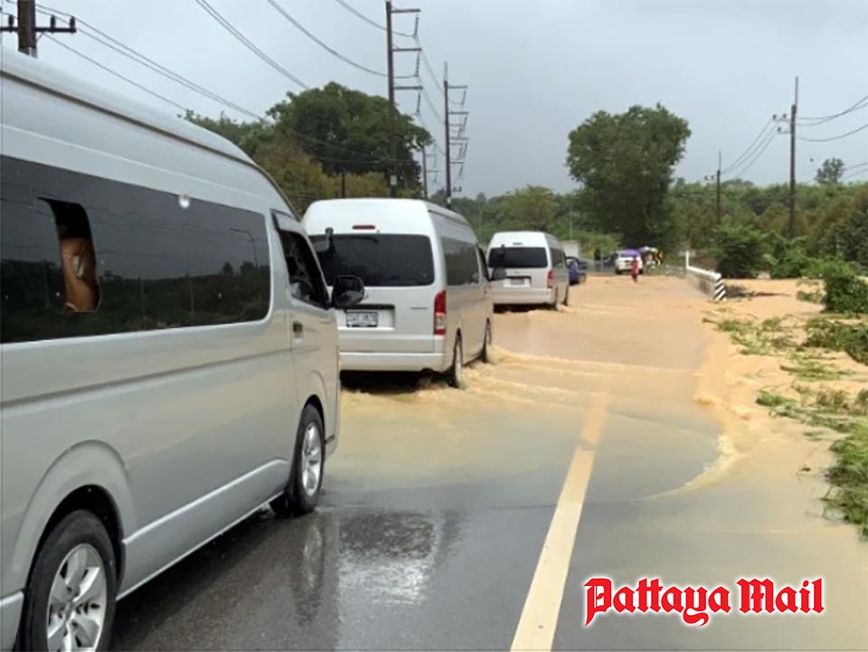
The deluge, which began before dawn and lasted more than three hours, affected large areas in Khao Saming and Laem Ngop districts. In particular, Route 3156 (Saen Tung–Bang Kadan), a major connector to ferry terminals and Trat Airport, was inundated near the Khlong Tha Som bridge. Water levels surged to 30–40 centimeters due to runoff from the Rakham mountain range and backflow from the Tha Som airfield area.
The rapid flooding made it temporarily impossible for small cars and motorcycles to pass, while high-clearance vehicles were forced to navigate with extreme caution due to the fast-flowing water. At one point, nearly 100 vehicles were backed up along both sides of the road, awaiting water to subside.
Local administrative officials from the Tha Som Subdistrict and volunteers from Sawang Boon Rescue Foundation were deployed to assist with traffic flow and help restore access. This road is critical, linking mainland travelers to ferry services bound for Koh Chang and to the nearby airport.
By late morning, as the rain eased, the water began to recede. At approximately 10:45 AM, larger vehicles resumed travel across the affected sections, though drivers were still advised to proceed slowly due to the strength of remaining water currents.
Elsewhere, Laem Ngop–Bang Kadan Road was also affected, particularly near the Bang Pit Subdistrict Administrative Office, where water levels reached 10–20 centimeters across both lanes. Traffic remained passable for all vehicle types, but moved slowly.
Authorities say drainage systems were overwhelmed by runoff from multiple tributaries, including Khlong Ya, Khlong Tha Som, and Khlong Nai in Saen Tung Subdistrict. While conditions have since improved, officials are monitoring the situation and advising travelers to check local updates before making their way to Koh Chang.
The National Water Data Center reported that accumulated rainfall in Trat Province reached as high as 126 millimeters in the Bang Pit Subdistrict Administrative Organization area within 24 hours.
Meanwhile, the Meteorological Department has issued a nationwide warning for heavy to very heavy rain, especially in Trat and Chanthaburi provinces, which are designated as red alert zones. These areas are expected to experience intense rainfall with accumulations reaching up to 90 millimeters from 6:00 AM Sunday until 6:00 AM Monday.
Safety Reminder:
Travelers heading to Koh Chang via ferry are urged to allow extra travel time, follow police or rescue official directions, and check real-time traffic and weather updates—especially during the rainy season.